
Geolocation OSINT: A blurry balcony. A red awning. A shadow falling at the wrong angle. That is sometimes all you get.
In modern investigations, wars are verified frame by frame, kidnappings are solved through building facades, and disinformation collapses under satellite scrutiny. The difference often comes down to one skill: Geolocation OSINT.
If Open Source Intelligence answers who and what, geolocation answers where. And in many cases, where changes everything.
This guide breaks down how geospatial intelligence works, which tools actually matter, and how analysts move from pixels to precise coordinates.
What Is Geolocation OSINT?
In simple terms, Geolocation OSINT—also called GEOINT—means identifying a real-world location by analyzing digital traces.
You take a photo, a video, a document, or an IP log. You extract environmental clues. You compare terrain, architecture, language, vegetation, and light. You anchor digital material to physical space.
Governments, defense contractors, and investigative journalists rely on this discipline daily. During conflicts in Ukraine and Syria, independent analysts verified missile strikes by matching crater patterns and skyline silhouettes with satellite imagery. That is GEOINT in practice.
At its core, this field bridges two worlds:
- The digital environment
- The physical landscape
And the bridge is built on evidence.
The Two Hemispheres of Location Analysis
To pinpoint where something happened, analysts combine two domains: visual interpretation and technical extraction.
Visual Analysis: Reading the Scene
Most geolocation cases begin with the eye.
Images and videos carry layered geographic signals. Some obvious. Many subtle.
A curb painted blue and white narrows a continent.
A utility pole design narrows a region.
A balcony railing pattern narrows a city.
Investigators look at:
- Roof shapes: flat roofs suggest Mediterranean climates; pitched roofs dominate snowy regions.
- Construction materials: Soviet-era concrete panel blocks still mark parts of Eastern Europe.
- Traffic signals: horizontal vs vertical mounting varies by country.
- Road markings: yellow center lines or white-only systems matter.
Professional analysts build pattern memory over time. It resembles language fluency. You stop translating details and start recognizing them.
AI can accelerate comparison. It cannot replace judgment.
Digital Analysis: Extracting Technical Clues
Visual interpretation works alongside technical data extraction.
Images and files may contain EXIF metadata, including:
- GPS coordinates
- Timestamp
- Device model
- Altitude
- Direction of capture
Social platforms often strip this data. Still, original uploads or shared documents sometimes retain it.
IP geolocation can identify a country or region. It rarely offers precision. Treat it as a starting zone, not a final answer.
Metadata viewers such as exif.tools can reveal hidden geographic signals in seconds.
When metadata exists, the investigation speeds up dramatically. When it does not, visual discipline carries the weight.
The Explorer’s Toolkit: Core GEOINT Platforms
Every geolocation analyst works with mapping and imagery platforms. Paper maps belong in history books.
Mapping and Satellite Platforms

Google Earth
The foundation of terrain analysis. Elevation, distances, coastline curvature, mountain silhouettes. It gives immediate geographic context.
Google Maps
Street-level data, business listings, reviews, public images. Useful for verifying storefronts, cafes, and addresses.
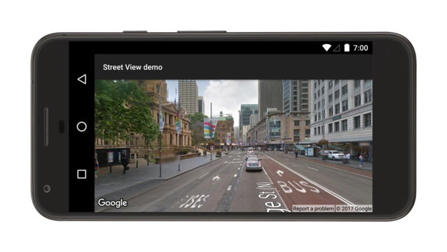
Google Street View
Critical for ground-level validation. Historical imagery helps confirm construction dates and structural changes.
Yandex Maps
Valuable across Eastern Europe and parts of Central Asia. Covers areas where Western platforms have gaps.
Bing Maps
Alternative street coverage. Different indexing sometimes reveals details others miss.
No single platform covers the entire globe perfectly. Cross-checking is standard practice.
Reverse Image Search and AI Geolocation


Traditional reverse image engines compare shapes, textures, and colors against indexed databases.
Google Lens
Quick and accessible. Good for detecting earlier uploads.
TinEye
Strong for historical indexing and duplicate tracking.
Yandex Images
Often effective for Eastern European datasets.
AI-based systems such as GeoSpy attempt deeper inference. They analyze skylines, vegetation, language fragments, and topography to predict coordinates.
These systems can impress. They can also hallucinate. A tropical coastline can confuse even advanced models.
Human validation remains mandatory.
Specialist Tools: When Details Matter
Sometimes the decisive clue hides in physics.
Shadow analysis relies on solar position calculators. By measuring shadow length and direction, analysts estimate time and hemisphere orientation.
Agricultural databases reveal where certain crops dominate. Soil color and vegetation density narrow climate zones.
Terrain comparison closes the case. Matching mountain ridgelines against satellite overlays often seals the answer.
Geolocation is triangulation. When independent clues converge, confidence rises.
Manual Geolocation Checklist: What to Look For
Elite analysts train their eyes. Beginners need structure.
Here is a practical review framework.
Architecture
- Window shapes
- Balcony types
- Roofing style
- Building density
Haussmann-style facades suggest Paris. Brutalist concrete blocks suggest former Soviet territories.
Road Infrastructure
- Lane marking colors
- Side of driving
- Bollard shape
- Sign typography
Even traffic light orientation can identify a country.
Language and Typography
Alphabet systems matter.
Latin, Cyrillic, Arabic, Mandarin. Domain suffixes on signs. Phone number formats. Dialect hints.
Text visible in the background often narrows location faster than landscape.
Vegetation and Ecology
Palm species imply tropical or subtropical zones. Conifer forests suggest temperate or boreal climates.
Dry grass and red soil tell a different story than lush green plains.
Shadow and Sun Position
Measure the angle. Compare with timestamps. Check solar path databases.
Shadow inconsistencies frequently expose fabricated capture dates.
Terrain and Topography
Mountain outlines. Coastal curvature. River bends. Soil hue.
Satellite overlay comparison remains one of the strongest closing techniques.
Geolocation OSINT in Action: A Scenario
A traveler disappears during a European trip. Before losing contact, she whispers: “White walls. Red curtains. Balcony.”
Her father reviews her social media.
He finds a video recorded earlier that day. In the background: cream-colored Haussmann buildings. Likely Paris.
He zooms into a café with distinctive red awnings.
Reverse image search identifies similar storefronts across Paris business listings.
He moves to Street View. He navigates candidate streets virtually. He checks balconies facing the café.
Only one alignment matches: white interior walls, red curtains, exterior balcony.
Metadata extraction reveals timestamp and device model. GPS coordinates are missing.
Daylight conditions match the upload time. The location fits.
Geolocation OSINT moves from broad region to specific street.
Step by step. Clue by clue.
Strengths and Limits of Geolocation OSINT
Advantages
- Independent verification of conflict footage
- Exposure of manipulated imagery
- Location tracing for investigative journalism
- Fraud and disinformation detection
Geolocation has reshaped war reporting. Independent analysts now verify frontline videos before major outlets publish them.
Limits
- Metadata often stripped
- AI prediction errors
- Incomplete satellite coverage
- Weather and seasonal landscape changes
AI geolocation tools can misidentify coastlines or confuse similar urban architecture. Blind trust leads to false certainty.
Cross-verification is not optional. It is survival.
Why Geolocation OSINT Matters Today
Digital manipulation grows more sophisticated each year. Deepfakes circulate globally within hours.
Location analysis anchors narratives to physical reality.
If a video claims to show an event in one city, geolocation can confirm or dismantle that claim in minutes.
Disinformation loses power when coordinates enter the discussion.
And for journalists, analysts, and cybersecurity professionals, mastering location analysis is no longer niche. It is foundational.
Key Lessons to Remember
Geolocation blends observation and technical extraction.
No single clue wins a case. Patterns do.
Tools accelerate research. Judgment closes it.
Triangulation builds certainty.
Every image carries geography. The question is whether you know how to read it.
Want to go deeper into OSINT techniques and investigative workflows?
Join our community:
Newsletter: https://projectosint.substack.com/
Telegram: https://t.me/osintprojectgroup
Location never lies. It only waits to be decoded.